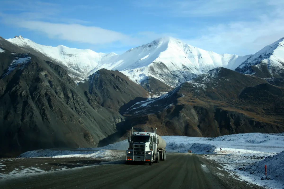
Embarking on the Dalton Highway offers an adventure beyond the ordinary, a journey into some of the most secluded and pristine areas of North America. This 414-mile route, popularized by the TV show "Ice Road Truckers," stretches from Livengood to Prudhoe Bay and is renowned for traversing Alaska's remote wilderness. Skirting alongside the iconic Trans-Alaska pipeline, the highway is defined by its rugged terrain, sparse services, and profound solitude. This comprehensive guide is designed to equip you with the necessary knowledge and tips for a safe, unforgettable expedition along one of the most solitary roads in the United States.
History of the Dalton Highway
The Dalton Highway was built in the 1970s primarily to support the construction of the Trans-Alaska Pipeline. This road, named after James W. Dalton, a key figure in early Alaskan oil exploration, initially functioned as a service route for pipeline operations. In a significant shift, the highway was opened to the public in 1994, transitioning from a private industrial road to an accessible path for adventure seekers.
In the winter, the Dalton Highway undergoes a dramatic transformation. It becomes a part of the renowned 'ice road' network, dominated by the famous ice road truckers who haul essential supplies up to Prudhoe Bay. While you still drive the road in the winter, it is extremely discouraged due to the icy conditions and extreme weather.
Over the years, the Dalton Highway has become an important tourist attraction. Its remote and challenging terrain makes it a unique destination for those seeking to experience the rugged beauty of the Arctic Circle. Despite its industrial origins, the highway's natural beauty continues to attract tourists from around the world.
Overview of Driving the Dalton Highway
Embarking on a drive along the Dalton Highway is an exercise in endurance and preparation. Many travelers opt to take a guided trip out of Fairbanks to experience the beauty of the road but avoid the logistical headache of solo driving the road. Here is a quick overview of the road to help you as you plan your trip:
- Road Length: The highway stretches for 414 miles, offering a long and challenging drive.
Starting and Ending Points: The journey begins in Livengood, a small town north of Fairbanks, and concludes in Prudhoe Bay, on the coast of the Arctic Ocean. - Optimal Travel Period: The best time to embark on this journey is during the summer months. The conditions during this period are more favorable, with longer daylight hours and generally better road conditions.
- Vehicle Requirements: A high-clearance, four-wheel drive vehicle is strongly recommended. The road's rough terrain with gravel sections, steep grades, and potential for sudden weather changes makes a sturdy, reliable vehicle essential. Most rental cars in Alaska do not permit driving on the Dalton, so you will either need to rent for a specific off-roading company or bring your own car.
- Travel Duration: A round trip on the Dalton Highway should ideally be planned over 4-5 days to account for rest, sightseeing, and any unforeseen delays.
Sample Itinerary
This section offers a detailed 4-day itinerary for the Dalton Highway, highlighting key stops, and scenic points along the route. You can drive only a portion of the road or the entire thing, depending on your time and durability. Many tours will travel up to the Arctic Circle before turning around – a great option if you are limited on time or want an easier trip.
Day 1
Depart from Fairbanks, heading towards Livengood, the gateway to the Dalton Highway. Early in the journey, you will encounter gravel sections, frost heaves, and potholes, necessitating a cautious driving approach.
Key stops include the iconic 'Start of the Dalton Highway' sign, Yukon River Bridge for a meal and fuel, and the Arctic Circle sign marking the entrance into the Arctic region (great day trip option from Fairbanks). Finger Mountain offers numerous hiking opportunities with its unique granite towers.
Day 2
Begin your day by exploring the Arctic Interagency Visitor Center in Coldfoot for valuable insights into local trails and history. The journey then continues through the majestic Brooks Range, with a stop at Atigun Pass, the highest highway pass in Alaska at 4,800 feet. This day offers opportunities for wildlife viewing, including Dall sheep, and ends in Deadhorse, where overnight camping or hotel stays are available (reservations are essential).
Day 3
Spend your third day exploring the surrounding areas of Prudhoe Bay, rich in wildlife and birdlife. The proximity to the oil fields adds an industrial contrast to the natural landscape. Plan ahead for a tour in Prudhoe Bay if you wish to dip your toes in the Arctic Ocean, as it requires passing through a secured area. Visitors are not allowed in the oil field or in the industrial area.
Day 4-5
Begin the return journey towards Coldfoot and Fairbanks. While it's possible to drive approximately 500 miles in one day, a more leisurely pace is advisable, due to wildlife crossing and road conditions. Plan to spend at least a few of your nights camping at one of the several BLM campgrounds along the route or at a remote campsite.
Preparing for the Trip
The Dalton Highway is not your average road, and a trip along its length will require careful planning and the right equipment. Services end just north of Fairbanks, so you will be making this journey almost entirely on your own, so be sure to carefully review the information below.
Road Conditions: Be prepared for a narrow, mostly gravel road with frequent dust, mud, and potholes. The road is heavily used by trucks, adding to the challenge. Windshield cracks, flat tires, dead batteries, and wildlife collisions are all common while driving the Dalton.
Weather: The highway can experience snow and ice at any time of the year, and summer brings the risk of wildfires. Always check the weather forecast and be prepared for sudden changes. Remember, in the winter, this highway is entirely iced-over.
Communications: Cell phone service is extremely limited along the highway. Only GCI and AT&T provide some coverage, mostly around Coldfoot. Bring an emergency beacon device on your trip and physical maps.
Lack of Services: Beyond Fairbanks, services are scarce, and nonexistent out of the summer season. Plan to be self-sufficient for at least 1,000 miles each way, including fuel, food, and nightly accommodations (more below).
Accommodations: Options are limited to camping and a few hotels, with reservations recommended. Campgrounds have only the bare essentials, and sites are not guaranteed, though you can open camp along most of the road.
Vehicle Prep: Ensure your vehicle is in top condition and approved to drive on the Dalton if you have a rental. Check tires, fluids, and have spare tires before you leave, and consider carrying a CB radio for truck traffic. Pack a full-sized spare tire with you and a tire patch kit.
Stay Informed: Always check current road conditions and alerts at 511.alaska.gov before and during your trip.
Yield to Truckers: The Dalton was founded as an oil road and it still remains that today. Large trucks are known to drive incredibly fast along this route, so be ready to pull over and yield the way to them. Pull entirely off the road to avoid gravel hitting your windshield.

